Bennar Beach Campsite
Bennar, a family friendly campsite just a stone’s throw from a beautiful sandy beach. (via site)
Location
Where Bennar Beach Campsite sits on the map and how to get there.
Nearby cities & towns
Towns and cities closest to Bennar Beach Campsite — browse campsites near each.
What’s nearby
Shops, drinking water, fuel and attractions within reach of the site.
🏞️ Attractions

Site of Special Scientific Interest in Wales

Morfa Dyffryn beach is on the west coast of Wales, between Barmouth and Harlech in Gwynedd. This sandy beach is several miles long and is chiefly known for having an officially recognised naturist area, 1 kilometre (1,100 yd) in length. The beach is very clean and is also known for regular sightings of dolphins. The nearest settlements are the villages of Dyffryn Ardudwy and Llanbedr where several
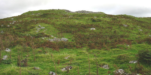
Pen-y-Dinas (deutsch „Kopf des Ortes“ – auch Cortin oder Gortyn genannt) ist ein eisenzeitliches Hillfort südöstlich von Talybont (auch Tal-y-bont), nördlich von Barmouth-Llanaber in Gwynedd in Wales. Der Eintrag im COFLEIN (Catalogue of archaeology, buildings, industrial and maritime heritage in Wales) umfasst Luftbilder von 1948 bis heute, die das Hillfort über der Küstenebene zeigen. Ein gleich

hill (457m) in Gwynedd


Mae Moelfre yn gopa mynydd a geir yn y Rhinogydd rhwng y Bermo a Betws-y-Coed a'r Bala; cyfeiriad grid SH626245. Saif tua thair milltir o bentref Dyffryn Ardudwy a 10 milltir o Harlech - ar ochr orllewinol y Rhinogau, gyda chopaon Y Llethr a Diffwys i'r dwyrain ohono. Uchder cymharol, neu ”amlygrwydd” y copa, ydy 427metr: dyma'r uchder mae'r copa'n codi uwchlaw'r mynydd agosaf.

Llandanwg () is a village in the Llanfair community of the Ardudwy area of Gwynedd, Wales. Situated on the coast, it has a railway station and a Grade II listed medieval church.

Arthog () is a village, post town and community in the Meirionnydd area in Gwynedd, north Wales including the villages of Fairbourne and Friog. It is located on the A493, approximately 8 miles (13 km) west of Dolgellau, and had a population of 1,010 in 2001, increasing slightly to 1,031 at the 2011 census.
🛒 Amenities & services
🛒 Groceries
- Dyffryn General Store
 Spar
Spar- Fox' Village Store
⛽ Fuel
- Fuel station
- Essar
🍽️ Food & drink
- The Plaice
- Dyffryn Inn
- Cadwgan Hotel
➕ Medical
- Rowlands Pharmacy
- Numark Pharmacy
🚰 Drinking water
- Drinking water
🚻 Toilets & showers
- Public toilets
- Showers
- Cefn Coed Campsite Facilities Block
🎾 Sports
- Swimming pool
- Tennis
- Equestrian
🏧 ATM & bank
- ATM
Weather
Current conditions and the forecast to help you plan your trip.
Best time to visit
Typical monthly temperature and rainfall at Bennar Beach Campsite.
Good to know
Quick answers to common questions about Bennar Beach Campsite.
Where is Bennar Beach Campsite located?
Bennar Beach Campsite is in Dyffryn Ardudwy.
Reviews
Ratings, nightly prices and photos from people who’ve camped here.
No reviews yet — be the first!
Other campgrounds nearby
More places to camp close to Bennar Beach Campsite.