Black Kettle Campground
Location
Where Black Kettle Campground sits on the map and how to get there.
What’s nearby
Shops, drinking water, fuel and attractions within reach of the site.
🏞️ Attractions
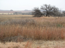
Washita Battlefield National Historic Site protects and interprets the site of the Southern Cheyenne village of Chief Black Kettle where the Battle of Washita occurred. The site is located about 150 miles (241 km) west of Oklahoma City, Oklahoma, near Cheyenne, Oklahoma. Just before dawn on November 27, 1868, the village was attacked by the 7th U.S. Cavalry under Lt. Col. George Custer. In the Bat

The Black Kettle National Grassland, in Roger Mills County, Oklahoma, and Hemphill County, Texas, contains 31,286 acres (12,661 ha) of which 30,710 acres (12,430 ha) are in Oklahoma.
🛒 Amenities & services
🚰 Drinking water
- Drinking water
🚻 Toilets & showers
- Public toilets
Weather
Current conditions and the forecast to help you plan your trip.
Best time to visit
Typical monthly temperature and rainfall at Black Kettle Campground.
Good to know
Quick answers to common questions about Black Kettle Campground.
Who runs Black Kettle Campground?
Black Kettle Campground is operated by USFS.
Reviews
Ratings, nightly prices and photos from people who’ve camped here.
No reviews yet — be the first!
Other campgrounds nearby
More places to camp close to Black Kettle Campground.
- Spring Creek Campground · USFS
- Skipout Campground · United States Forest Service
- Lake Marvin Campground · USFS