Buzzards Rest CL Caravan Site
Location
Where Buzzards Rest CL Caravan Site sits on the map and how to get there.
Nearby cities & towns
Towns and cities closest to Buzzards Rest CL Caravan Site — browse campsites near each.
What’s nearby
Shops, drinking water, fuel and attractions within reach of the site.
🏞️ Attractions


Long Hole, also spelled Longhole, is a limestone cave on the south coast of the Gower Peninsula between Paviland and Port Eynon. It is relatively small, measuring about 15 m (49 ft) deep after several excavations. It was first excavated in 1861 by Colonel E. R. Wood. Wood found evidence of a lithic assemblage and faunal remains. The faunal remains included cave hyena, reindeer, Woolly rhinoceros,
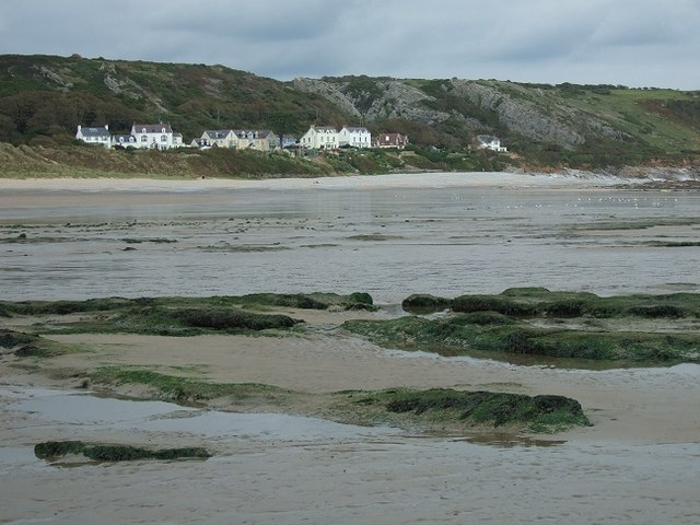
Horton Beach is located in Port Eynon Bay on the south coast of the Gower Peninsula in Wales. It is reached from the nearby village of Horton via a steep hill, and has a car park sited a few minutes' walk away. Despite its accessibility and its popularity with surfers, the beach is usually very quiet and it has sand even at high tide.

shipwreck, 880 m from Rhossili

Rhossili (Welsh: Rhosili; ) is a small village and community on the southwestern tip of the Gower Peninsula in Wales. It is within the first Area of Outstanding Natural Beauty in the United Kingdom. The village has a community council and is part of the Gower parliamentary constituency, and the Gower electoral ward. At the 2011 census, the population was 278. The community includes the hamlet of M

hill (152m) in City and County of Swansea

Slade Bay - marked on Ordnance Survey maps as "The Sands" - is a sandy beach near the village of Slade, on the Gower Peninsula in South West Wales. It is set in a relatively inaccessible location - being reachable only on foot and climbing over some large rocks. At the back of the beach, worked fields and steep gorse-clad cliffs are visible.

Rhossili Bay ist sowohl der Name des Strandabschnittes als auch der Bucht selbst nahe dem Ort Rhossili auf der Halbinsel Gower in Süd-Wales. Mit fast fünf Kilometern Länge ist der Strand Rhossili Bay der zweitlängste durchgehende und westlichste Strandabschnitt auf Gower. Eingerahmt wird er von den Gezeiteninseln Worm’s Head im Süden und Burry Holms im Norden. Nach Osten liegt direkt die Hügelkett
🛒 Amenities & services
🛒 Groceries
- The Village Shop
- Pitton Farm Shop
- Convenience
⛽ Fuel
- Knelston Garage
 Esso
Esso- North Road Service Station
🍽️ Food & drink
- Chips Ahoy
- Granary café
- The Ship Inn
➕ Medical
- Well Pharmacy
- Gower Medical Practice
- Pennard Surgery
🚰 Drinking water
- Drinking water
🚻 Toilets & showers
- Public toilets
- Showers
🎾 Sports
- Swimming
- Rugby
- Tennis
🏧 ATM & bank
- ATM
Weather
Current conditions and the forecast to help you plan your trip.
Best time to visit
Typical monthly temperature and rainfall at Buzzards Rest CL Caravan Site.
Reviews
Ratings, nightly prices and photos from people who’ve camped here.
No reviews yet — be the first!
Other campgrounds nearby
More places to camp close to Buzzards Rest CL Caravan Site.