dukMé?em wáta Campground
Location
Where dukMé?em wáta Campground sits on the map and how to get there.
Nearby cities & towns
Towns and cities closest to dukMé?em wáta Campground — browse campsites near each.
What’s nearby
Shops, drinking water, fuel and attractions within reach of the site.
🏞️ Attractions

Ed Z'berg Sugar Pine Point State Park is a state park in California in the United States. It occupies nearly two miles of the western shore of Lake Tahoe and a total of about 1,000 hectares of forested mountains in El Dorado County. Originally called Sugar Pine Point State Park, its name was changed in 2003 to honor Edwin L. Z'berg, a California state assemblyman who specialized in environmental l

Meeks Creek is a western tributary of Lake Tahoe which has its source on Rubicon Lake, 1.2 miles (1.9 km) northeast of Phipps Peak in Desolation Wilderness, trends northwest through Stony Ridge Lake, Shadow Lake, Crag Lake, and Lake Genevieve 3.5 miles (5.6 km), continues northeast 3.5 miles (5.6 km) to Meeks Bay on Lake Tahoe. At its mouth is the tiny town of Meeks Bay, in El Dorado County, Calif
Chambers Lodge (also, McKinney) was a historical lodge and post office in Placer County, California. Chambers Lodge was located on Lake Tahoe, 1.25 miles (2.0 km) southeast of Homewood, at an elevation of 6237 feet (1901 m). It was one of the oldest recreational lodges on Lake Tahoe, first established in 1854. After a succession of ownership changes, the lodge was ultimately demolished in 1970,

Meeks Creek is a western tributary of Lake Tahoe which has its source on Rubicon Lake, 1.2 miles (1.9 km) northeast of Phipps Peak in Desolation Wilderness, trends northwest through Stony Ridge Lake, Shadow Lake, Crag Lake, and Lake Genevieve 3.5 miles (5.6 km), continues northeast 3.5 miles (5.6 km) to Meeks Bay on Lake Tahoe. At its mouth is the tiny town of Meeks Bay, in El Dorado County, Calif

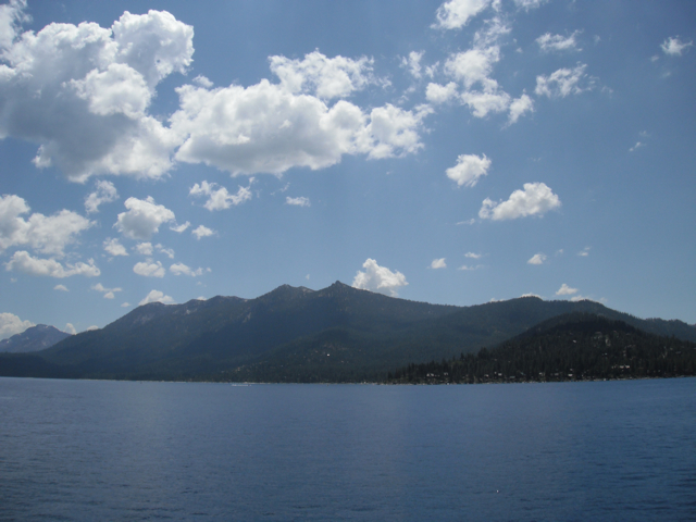
Rubicon (also called "Rubicon Bay") is a former settlement in El Dorado County, California, United States. It was located on Lake Tahoe 4.5 miles (7.2 km) north of Emerald Bay. A post office operated at Rubicon from 1901 to 1906 and from 1909 to 1913, located at the "northeast quarter of Section 4 of Township 13 North, Range 17 East" (of the Mount Diablo meridian). It sat 1/16th (330 feet) north
🛒 Amenities & services
🛒 Groceries
- Tahoma Market and Deli
- Obexer's General Store & Deli
- West Shore Market & Deli
🍽️ Food & drink
- Where We Met
- Cult Burger
- The Dog and Bear Tavern
🚰 Drinking water
- Drinking water
🚻 Toilets & showers
- Public toilets
- Maid's Cabin
- Showers
🎾 Sports
- Tennis
- Swimming pool
- Beachvolleyball
Weather
Current conditions and the forecast to help you plan your trip.
Best time to visit
Typical monthly temperature and rainfall at dukMé?em wáta Campground.
Reviews
Ratings, nightly prices and photos from people who’ve camped here.
No reviews yet — be the first!
Other campgrounds nearby
More places to camp close to dukMé?em wáta Campground.
- Meeks Bay Campground and Resort · U.S. Forest Service
- D.L Bliss State Park - Beach Camp · California State Parks
- D.L Bliss State Park - Group Camp · California State Parks
- D.L Bliss State Park - East Ridge · California State Parks
- D.L Bliss State Park - West Ridge · California State Parks
- Kaspian Campground