Fron Francis
Location
Where Fron Francis sits on the map and how to get there.
Nearby cities & towns
Towns and cities closest to Fron Francis — browse campsites near each.
What’s nearby
Shops, drinking water, fuel and attractions within reach of the site.
🏞️ Attractions


The Grey Mare's Tail is a waterfall on the very edge of the Snowdonia National Park near Gwydir Castle in Conwy County Borough, north Wales. It lies just off the B5106 road between the town of Llanrwst and the large village of Trefriw. The Welsh name, Rhaeadr y Parc Mawr, derives from the fact that the falls are fed by a large stream that has its source in the Gwydir Forest, and flows through the

Cadair Ifan Goch (Chair of Ifan Goch, the Giant) is a crag located above the Conwy Valley in North Wales in the community of Llanddoged and Maenan, and owned by the National Trust. The views extend across the whole of the valley to the Carneddau mountains, and even as far south as the Arenig mountains. The summit of the hill, a bit further up from the crag, reaches 207 metres (679 ft) above sea le
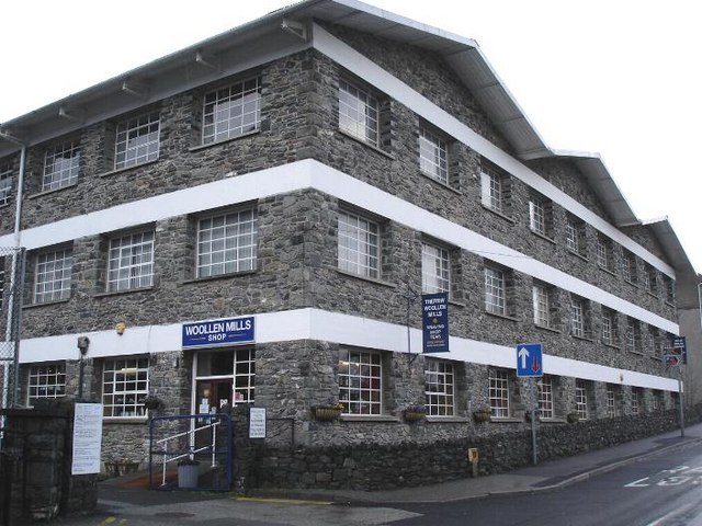
Trefriw Woollen Mills is a woollen mill in the village of Trefriw, Conwy, in northern Wales, that has been operating since around 1825.

The Fairy Falls are a waterfall in the village of Trefriw, north Wales. The falls are on the river Crafnant which has its source at Llyn Crafnant, being joined upstream by a tributary, the river Geirionydd. Below the falls the river Crafnant flows on to itself become a tributary of the river Conwy.

Trefriw (Welsh pronunciation: [trɛˈvrɪu]) is a village and community in Conwy County Borough, Wales. It lies on the river Crafnant a few miles south of the site of the Roman fort of Canovium, sited at Caerhun. At the last three censuses, the population of the community has been recorded as 842 in 1999, 915 in 2001, and 783 in 2011 (from a total of 368 households). Trefriw lies on the edge of Snowd
hill (287m) in Conwy County Borough

🛒 Amenities & services
🛒 Groceries
 Co-op Food
- Harp Stores
- Health & Food Llanrwst
⛽ Fuel
 Meadowvale
 Shell
Shell
🍽️ Food & drink
- Chandlers Brasserie
- Old Ship
- Fairy Falls
➕ Medical
- Boots
🚰 Drinking water
- Drinking water
🚻 Toilets & showers
- Public toilets
- Showers
🎾 Sports
- Soccer
- Rugby union
- Pant Carw
🏧 ATM & bank
- ATM
Weather
Current conditions and the forecast to help you plan your trip.
Best time to visit
Typical monthly temperature and rainfall at Fron Francis.
Reviews
Ratings, nightly prices and photos from people who’ve camped here.
No reviews yet — be the first!
Other campgrounds nearby
More places to camp close to Fron Francis.