Holter Lake State Recreation Area
Location
Where Holter Lake State Recreation Area sits on the map and how to get there.
Nearby cities & towns
Towns and cities closest to Holter Lake State Recreation Area — browse campsites near each.
What’s nearby
Shops, drinking water, fuel and attractions within reach of the site.
🏞️ Attractions
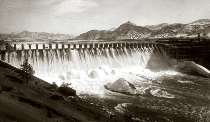
Holter Dam is a hydroelectric straight gravity dam on the Missouri River about 45 miles (72 km) northeast of Helena, Montana, in the United States. The dam, which was built between 1908 and 1918, is 1,364 feet (416 m) long and 124 feet (38 m) high. The reservoir formed by the dam, Holter Lake (also known as Holter Reservoir) is 25 miles (40 km) long and has a storage capacity of 243,000 acre-feet
🛒 Amenities & services
🛒 Groceries
- Convenience
- Canyon Store
⛽ Fuel
 Exxon
Exxon- Fuel station
🍽️ Food & drink
- Uncle Joe's Oasis Bar & Grill
- Shotgun Annies Saloon, Tavern, & Bar
- Izaak's Restaurant
🚰 Drinking water
- Drinking water
🚻 Toilets & showers
- Public toilets
🎾 Sports
- Beachvolleyball
Weather
Current conditions and the forecast to help you plan your trip.
Best time to visit
Typical monthly temperature and rainfall at Holter Lake State Recreation Area.
Reviews
Ratings, nightly prices and photos from people who’ve camped here.
No reviews yet — be the first!
Other campgrounds nearby
More places to camp close to Holter Lake State Recreation Area.