Long Rivers Council (Boy Scouts Of America)
Location
Where Long Rivers Council (Boy Scouts Of America) sits on the map and how to get there.
Nearby cities & towns
Towns and cities closest to Long Rivers Council (Boy Scouts Of America) — browse campsites near each.
What’s nearby
Shops, drinking water, fuel and attractions within reach of the site.
🏞️ Attractions
park in Litchfield County, Connecticut, United States of America
mountain in Connecticut, United States of America

Haystack Mountain is a 1,680-foot-high (510 m) mountain topped with an observation tower that is the chief features of Haystack Mountain State Park, a 354-acre public recreation area in the town of Norfolk, Connecticut.
mountain in Litchfield County, Connecticut, United States of America


Norfolk is a town in Litchfield County, Connecticut, United States. The population was 1,588 at the 2020 census. The town is part of the Northwest Hills Planning Region. The urban center of the town is the Norfolk census-designated place, with a population of 553 at the 2010 census. Norfolk is the home of the Norfolk Chamber Music Festival, an annual chamber music concert series hosted by the Yale

Campbell Falls State Park Reserve is an undeveloped, public recreation area and nature preserve located in the town of Norfolk, Connecticut. The 102-acre (41 ha) state park offers hiking, stream fishing, and views of the park's namesake waterfall which cascades nearly 100 feet (30 m) on the Whiting River just north of the Connecticut/Massachusetts state line. Legislation passed in 1923 and 1924 pr
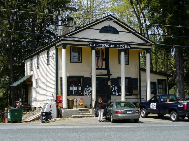
The Colebrook Store is a historic commercial building at 559 Colebrook Road in the village center of Colebrook, Connecticut. Built in 1812, it has operated as a local general store since then, and is an architectural landmark for its two-story temple front. It was listed on the National Register of Historic Places in 1976.
🛒 Amenities & services
🛒 Groceries
- Chipmunk Market
- Convenience
⛽ Fuel
 Shell
🍽️ Food & drink
- Mizza's Pizza
- Woodcreek Bar and Grill
- The Southfield Store
🚻 Toilets & showers
- Public toilets
- Showers
- Field Laundry & Showers
🎾 Sports
- Tennis
- Swimming pool
- Baseball
🏧 ATM & bank
- National Iron Bank
Weather
Current conditions and the forecast to help you plan your trip.
Best time to visit
Typical monthly temperature and rainfall at Long Rivers Council (Boy Scouts Of America).
Reviews
Ratings, nightly prices and photos from people who’ve camped here.
No reviews yet — be the first!
Other campgrounds nearby
More places to camp close to Long Rivers Council (Boy Scouts Of America).
- Camp Jewell · YMCA of Metrpolitan Hartford
- Bobriwka · Bobriwka Inc.
- Lone Oak Campsites · Lone Oak Campsites
- Camp Ouleout (Ymca)
- White Pines Campsites
- Nw Ctgirl Scout Council (Camp Maria Pratt)