Lower Lee Vining Campground
Find and Discover Recreation Sites and Trails in Inyo National Forest (via site)
Key facts
At-a-glance details for Lower Lee Vining Campground, from its official website.
Pitches & accommodation
Facilities & details
Amenities and on-site features reported for Lower Lee Vining Campground.
Know before you go
Practical things to prepare for a trip to Lower Lee Vining Campground.
- Bring cash for fees in case card payment isn't available on site.
Location
Where Lower Lee Vining Campground sits on the map and how to get there.
What’s nearby
Shops, drinking water, fuel and attractions within reach of the site.
🏞️ Attractions


mountain in California, United States of America
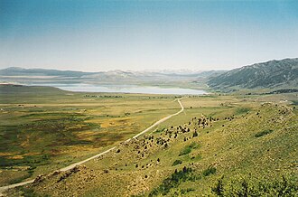
The Mono Basin National Forest Scenic Area is a protected area in Eastern California that surrounds Mono Lake and the northern half of the Mono Craters volcanic field. It is administered by the Inyo National Forest as a unit of the National Forest Scenic Area program, under the U.S. Forest Service.
mountain in California, United States of America

Lee Vining Peak is an 11,690-foot-elevation (3,560-meter) summit located in the Sierra Nevada mountain range, in Mono County of northern California, United States. The mountain is set within the Hoover Wilderness, on land managed by Inyo National Forest. The peak is situated north of Lee Vining Canyon, and 1.8 miles (2.9 km) southeast of Mount Warren, which is the nearest higher neighbor. Topograp
beach in Mono County, California, United States

🛒 Amenities & services
🛒 Groceries
- Convenience
- Mono Market
 Chevron
⛽ Fuel
 Mobil
 Shell
- Chevron
🍽️ Food & drink
- Whoa Nellie Deli
- Epic Cafe
- Nicely's
🚰 Drinking water
- Drinking water
🚻 Toilets & showers
- Showers
- Public toilets
🎾 Sports
- Baseball
- Soccer
- Tennis
🏧 ATM & bank
- ATM
Weather
Current conditions and the forecast to help you plan your trip.
Best time to visit
Typical monthly temperature and rainfall at Lower Lee Vining Campground.
Good to know
Quick answers to common questions about Lower Lee Vining Campground.
How much does it cost to camp at Lower Lee Vining Campground?
Lower Lee Vining Campground charges a camping fee.
Do I need to book ahead for Lower Lee Vining Campground?
No — it's first-come, first-served.
How many sites does Lower Lee Vining Campground have?
Lower Lee Vining Campground has around 51 pitches.
Who runs Lower Lee Vining Campground?
Lower Lee Vining Campground is operated by Inyo National Forest.
Reviews
Ratings, nightly prices and photos from people who’ve camped here.
No reviews yet — be the first!
Other campgrounds nearby
More places to camp close to Lower Lee Vining Campground.
- Cattleguard Campground
- Moraine Campground · Inyo National Forest
- Camp Azuza Senior Camp
- Aspen Grove Campground · Inyo National Forest
- Mono Vista RV Park
- Big Bend Campground