Morfa Farm Caravan Park
Facilities & details
Amenities and on-site features reported for Morfa Farm Caravan Park.
Location
Where Morfa Farm Caravan Park sits on the map and how to get there.
Nearby cities & towns
Towns and cities closest to Morfa Farm Caravan Park — browse campsites near each.
What’s nearby
Shops, drinking water, fuel and attractions within reach of the site.
🏞️ Attractions

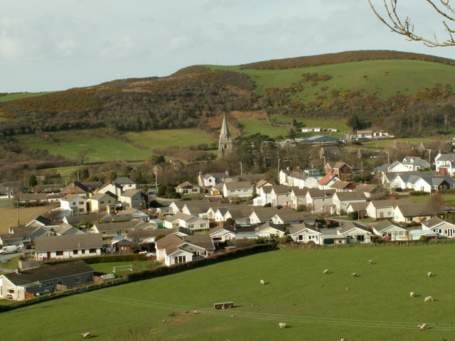
Llanrhystud (Welsh pronunciation: [ɬanˈr̥əstɪd]) is a seaside village, community and electoral division on the A487 road in the county of Ceredigion, in Wales, 9 miles (14 km) south of Aberystwyth, and 7 miles (11 km) north of Aberaeron. It takes its name from an early Welsh saint. The community includes the village of Llanddeiniol. The Cofiwch Dryweryn stone wall (meaning: "Remember Tryweryn") li

Grade II listed building in Ceredigion. Situated on E side of village, alongside by-road, E of Maes-y-felin. Afon Wyre to S, Afon Carrog to N.

Llanon (Welsh pronunciation: [ɬanˈɔn]; also spelled Llan-non) is a village in Ceredigion, Wales. It adjoins the village of Llansantffraed on the coast of Cardigan Bay, 5 mi (8.0 km) north of Aberaeron and 11 miles (18 km) south of Aberystwyth on the A487 road. It is situated on a raised beach. The village is named after the church of Saint Non (Llan-Non), the mother of Saint David. By tradition, S

Mynydd-bach, also spelled Mynydd-Bach, Mynydd Bach, Mynyddbach and Mynydd-bâch, a Welsh word meaning a 'little mountain', may refer to the following places in Wales:Mynydd-Bach, Swansea, also spelled Mynydd-bach, Mynyddbach, Mynydd Bach, district of Swansea Mynyddbach Chapel, chapel in Swansea Mynydd-bach, formerly Mynyddbach, electoral ward in Swansea Mynydd Bach (hills), hills in Ceredigion Myny
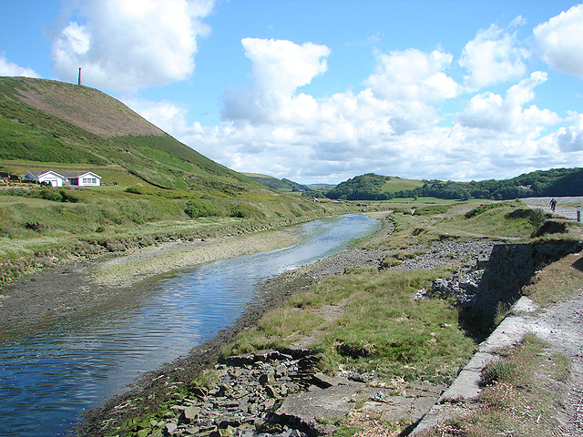
Tan-y-Bwlch (Welsh for 'Under the pass / gap') is a beach near Aberystwyth, Wales, forming part of the Pen Dinas and Tan-y-Bwlch Local Nature Reserve (LNR), the majority of which is located in the village of Penparcau. The area was designated in 1999 following a public meeting which attracted more than 100 local people. The 100-acre (0.40 km2) site contains the Bronze Age burial mound and Iron Age

hill (361m) in Ceredigion
🛒 Amenities & services
🛒 Groceries
 Costcutter
- Llanrhystud Post Office
- Convenience
⛽ Fuel
 Texaco
- Murco
- Aeron Coast
🍽️ Food & drink
- Restaurant
- Cafe
- Black Lion
➕ Medical
- Allied Pharmacy
- Boots
- Tanyfron Primary Care (GP)
🚻 Toilets & showers
- Public toilets
🎾 Sports
- Tennis
- Llanrhystud Park
- Penrhos Swimming Pool
🏧 ATM & bank
- Aberaeron Stores ATM
Weather
Current conditions and the forecast to help you plan your trip.
Best time to visit
Typical monthly temperature and rainfall at Morfa Farm Caravan Park.
Good to know
Quick answers to common questions about Morfa Farm Caravan Park.
Is Morfa Farm Caravan Park wheelchair accessible?
Yes, it's wheelchair accessible.
Reviews
Ratings, nightly prices and photos from people who’ve camped here.
No reviews yet — be the first!
Other campgrounds nearby
More places to camp close to Morfa Farm Caravan Park.