Morrillos
Location
Where Morrillos sits on the map and how to get there.
Nearby cities & towns
Towns and cities closest to Morrillos — browse campsites near each.
What’s nearby
Shops, drinking water, fuel and attractions within reach of the site.
🏞️ Attractions
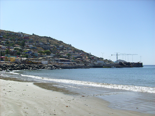
Guanaqueros Bay (Spanish: Bahía de Guanaqueros) is a bay in Chile's Coquimbo Region. The bay is U-shaped, open to the northwest. Its western boundary is made up by Punta Guanaquero, a spur of Cerro Guanaqueros. The beach of Guanaros Bay lies about 34 km south of the port city of Coquimbo. The area around the bay has a cold desert climate.
🛒 Amenities & services
🛒 Groceries
- Supermercado Auco
- Caleta de Guanaqueros
- D'Zambra
🍽️ Food & drink
- Mamakuta
- La parrilla
- La Cabrilla
➕ Medical
- Posta de salud rural Guanaqueros
- Posta de salud rural tambillo
🚻 Toilets & showers
- Public toilets
🎾 Sports
- Soccer
- Swimming pool
- Estadio Municipal Guanaqueros
🏧 ATM & bank
 Cajero Banco de Chile
Weather
Current conditions and the forecast to help you plan your trip.
Best time to visit
Typical monthly temperature and rainfall at Morrillos.
Reviews
Ratings, nightly prices and photos from people who’ve camped here.
No reviews yet — be the first!
Other campgrounds nearby
More places to camp close to Morrillos.