Northdown Farm
Opening hours & schedules
Reception, gate and facility hours for Northdown Farm.
Facilities & details
Amenities and on-site features reported for Northdown Farm.
Location
Where Northdown Farm sits on the map and how to get there.
Nearby cities & towns
Towns and cities closest to Northdown Farm — browse campsites near each.
What’s nearby
Shops, drinking water, fuel and attractions within reach of the site.
🏞️ Attractions

Osmington is a village and civil parish within Dorset, England, situated on the Jurassic Coast 4 miles (6.4 km) north-east of Weymouth. In the 2011 census the parish—which includes the small settlements of Upton, Ringstead and Osmington Mills—had a population of 673.


The Osmington White Horse is a hill figure cut into the limestone of Osmington Hill just north of Weymouth in Dorset in 1808. It is in the South Dorset Downs in the parish of Osmington. The figure depicts King George III riding his horse and can be seen for miles around. The king was a regular visitor to Weymouth and made it 'the first resort'. The figure is 280 feet (85 m) long and 323 feet (98 m
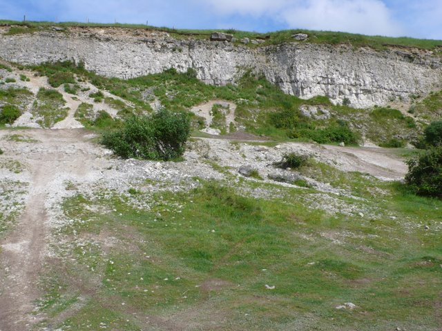
Chalbury Hill And Quarry (grid reference SY694838) is an 11.9 hectare biological and geological Site of Special Scientific Interest in Dorset, England, notified in 1977. The site consists of grassland (10.3 hectare) and a disused limestone quarry (1.6 hectare). The SSSI includes the area covered by Chalbury Hill Fort.


The Weymouth and Portland National Sailing Academy is a centre for the sport of sailing on the Isle of Portland, Dorset, on the south coast of England. The academy building is located in Osprey Quay on the northern tip of the island, and the waters of Portland Harbour and Weymouth Bay, adjacent to the site, are the main areas used for sailing. Local, national and international sailing events have

Chesil Beach is a major shingle beach structure in Dorset, England. Behind the beach is the Fleet, a shallow tidal lagoon. The beach runs for a length of 29 kilometres (18 mi) from West Bay to the Isle of Portland and in places is up to 15 metres (50 ft) high and 200 metres (660 ft) wide. The beach is often identified as a tombolo, although research has revealed that it is in fact a barrier beach.

Man o' War Cove (or Man of War Bay and similar names) lies on the Dorset coast in southern England and is flanked by the rocky, steep and slightly projecting headlands of Durdle Door to the west and Man O War (or O' War) Head to the east. Its name is believed to be a corruption of the Brythonic 'Men-an-Vawr' (The Great Rock)
🛒 Amenities & services
🛒 Groceries
 Spar
Spar Co-op Food
- Convenience
⛽ Fuel
 Esso
Esso Tesco
Tesco Osprey Quay Service Station
🍽️ Food & drink
- Stracey's Fish and Chips
- The Spice Ship
- Preston Fish & Chips
➕ Medical
- Numark
- Formotion Clinics
- Rowlands Pharmacy
🚰 Drinking water
- Drinking water
🚻 Toilets & showers
- Public toilets
- Showers
- Harbour Patrons Shower & Toilet Facilities
🎾 Sports
- Swimming pool
- Came Down Golf Club
- Greenhill Bowls Club
🏧 ATM & bank
- ATM
 Barclays
Weather
Current conditions and the forecast to help you plan your trip.
Best time to visit
Typical monthly temperature and rainfall at Northdown Farm.
Good to know
Quick answers to common questions about Northdown Farm.
Can I bring an RV or caravan to Northdown Farm?
No, caravans and RVs aren't permitted here.
Can I pitch a tent at Northdown Farm?
Yes, tent camping is allowed.
Are there toilets at Northdown Farm?
Yes, toilets are available on site.
Are showers available at Northdown Farm?
Yes, showers are available.
When is Northdown Farm open?
Listed opening times: May 24-Jun 01; Jul 23-Aug 10.
Reviews
Ratings, nightly prices and photos from people who’ve camped here.
No reviews yet — be the first!
Other campgrounds nearby
More places to camp close to Northdown Farm.