Oathill Campsite
The perfect rural retreat. Nestling deep in the heart of the beautiful countryside on the borders of Somerset and Dorset. Oathill Farm sits within ten tranquil , carefully landscaped acres. (via site)
Location
Where Oathill Campsite sits on the map and how to get there.
Nearby cities & towns
Towns and cities closest to Oathill Campsite — browse campsites near each.
What’s nearby
Shops, drinking water, fuel and attractions within reach of the site.
🏞️ Attractions
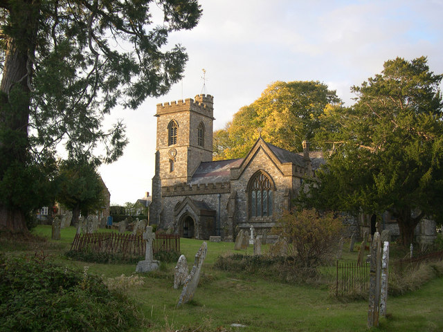
Thorncombe is a village and civil parish in the English county of Dorset. It was historically, until 1844, an exclave of Devon. It lies five miles (8 km) south east of the town of Chard in neighbouring Somerset. Thorncombe is situated close to the borders of both Somerset and Devon. In the 2011 census the population of the civil parish was 687.

Crewkerne and District Museum is a small local museum in Crewkerne, Somerset, England. It is part of a wider heritage centre which includes local archives and a meeting room.


Crinkley Bottom, also popularly referred to as Blobbyland, was the operating title for a series of British theme parks operating in England in the 1990s. They were created by Noel Edmonds based on the fictional village of Crinkley Bottom where the Noel's House Party television programme was based. The parks operated based on the popularity of Mr Blobby. Three parks were operated under the Crinkley

Lewesdon Hill is a hill near Broadwindsor in west Dorset, England. With a maximum elevation of 279 m (915 ft), it is the highest point in Dorset. The hill is owned and managed by the National Trust and is part of the Dorset National Landscape.

Pilsdon Pen is a 277-metre (909 ft) hill in Dorset in South West England, situated at the north end of the Marshwood Vale, approximately 4.5 miles (7.2 km) west of Beaminster. It is Dorset's second highest point and has panoramic views extending for many miles. It was bequeathed to the National Trust by the Pinney family in 1982. For many years it was thought to be Dorset's highest hill, until mod

Mosterton is a village and civil parish in Dorset, England, situated approximately 3 miles (4.8 km) north of Beaminster. In the 2011 census the parish had a population of 604. The village's name derives from Old English and means the thorn tree belonging to a man named Mort. In 1086 it was recorded in the Domesday Book as Mortestorne. Mosterton is a linear settlement, grown along the A3066 road. I
🛒 Amenities & services
🛒 Groceries
- Thorncombe Village Shop
- Broadwindsor Community Shop
- Central
⛽ Fuel
- Kittwhistle Garage
 Valero
 Texaco
🍽️ Food & drink
- Royal Oak
- The Squirrel Inn
- The Bell
➕ Medical
- Crewkerne Pharmacy
- Crewkerne Hospital
- Boots
🚻 Toilets & showers
- Public toilets
🎾 Sports
- Swimming pool
- Tennis
- Equestrian
🏧 ATM & bank
- Nationwide
 ATM
ATM
Weather
Current conditions and the forecast to help you plan your trip.
Best time to visit
Typical monthly temperature and rainfall at Oathill Campsite.
Reviews
Ratings, nightly prices and photos from people who’ve camped here.
No reviews yet — be the first!
Other campgrounds nearby
More places to camp close to Oathill Campsite.