Strawberry Fields
Location
Where Strawberry Fields sits on the map and how to get there.
Nearby cities & towns
Towns and cities closest to Strawberry Fields — browse campsites near each.
What’s nearby
Shops, drinking water, fuel and attractions within reach of the site.
🏞️ Attractions

Skipsea is a village and civil parish on the North Sea coast of the East Riding of Yorkshire, England. It is situated approximately 10 miles (16 km) south of Bridlington and 6 miles (9.7 km) north of Hornsea on the B1242 road at its junction with the B1249 road. The civil parish is formed by the village of Skipsea and the hamlets of Skipsea Brough and Dringhoe. According to the 2011 UK census, Ski

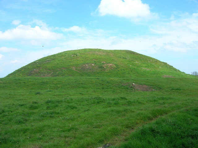
Skipsea Castle was a Norman motte and bailey castle near the village of Skipsea, East Riding of Yorkshire, England. Built around 1086 by Drogo de la Beuvrière, apparently on the remains of an Iron Age mound, it was designed to secure the newly conquered region, defend against any potential Danish invasion and control the trade route across the region leading to the North Sea. The motte and the bai

Skirlington is a hamlet in the Holderness area of the East Riding of Yorkshire, England. It is situated approximately 3.5 miles (5.6 km) north of Hornsea on the North Sea coast off the B1242 road. It forms part of the civil parish of Atwick. The hamlet's name was originally recorded in Old English as Scirleaingaton and was probably derived from the nearby village of Skirlaugh, whose name is a dou

Ulrome is a village and civil parish in the East Riding of Yorkshire, England. It is situated approximately 6 miles (9.7 km) north of the town of Hornsea and on the east side of the B1242 road. The parish includes the village of Lissett. Its area is 1,139.535 hectares (2,815.85 acres), in 2011 had a population of 239, a reduction on the 2001 UK census figure of 260. The parish church of St Andrew


local museum in Hornsea, England, United Kingdom

museum in North Frodingham, England, UK

🛒 Amenities & services
🛒 Groceries
- Mace
- Nisa Local
- Beeford Post Office
⛽ Fuel
 Tesco
- Cherrys
- Rix
🍽️ Food & drink
- Mr Moo's Ice Cream Parlour & Coffee Shop
- Board Inn
- Crossways Fish Shop
➕ Medical
- Beeford Surgery
- Hornsea Cottage Hospital
- Eastgate Medical Group
🚰 Drinking water
- Drinking water
🚻 Toilets & showers
- Marine Drive Public Tiolets
- Market Place Public Toilets
- Hall Garth Park Public Toilets
🎾 Sports
- Far Grange Park & Golf Club
- Bowls
- Tennis
🏧 ATM & bank
 Banking Hub
 ATM
- Barclays
Weather
Current conditions and the forecast to help you plan your trip.
Best time to visit
Typical monthly temperature and rainfall at Strawberry Fields.
Good to know
Quick answers to common questions about Strawberry Fields.
Where is Strawberry Fields located?
Strawberry Fields is in Driffield.
Reviews
Ratings, nightly prices and photos from people who’ve camped here.
No reviews yet — be the first!
Other campgrounds nearby
More places to camp close to Strawberry Fields.
- Mill Farm Country Park
- Skipsea Sands Holiday Park · Parkdean Resorts UK Limited
- Far Grange Park
- Far Grange Park
- Seaside Caravan Park
- Top View Caravan Park