Sycamore Camp
Facilities & details
Amenities and on-site features reported for Sycamore Camp.
Location
Where Sycamore Camp sits on the map and how to get there.
Nearby cities & towns
Towns and cities closest to Sycamore Camp — browse campsites near each.
What’s nearby
Shops, drinking water, fuel and attractions within reach of the site.
🏞️ Attractions

The San Rafael Wilderness is a wilderness area in the mountains of north central Santa Barbara County, California, United States. It is north of the city of Santa Barbara and east of Santa Maria within the Los Padres National Forest. Formed in 1968, it was the first wilderness area to be created from a previously designated Primitive Area after the passage of the 1964 Wilderness Act. It also inclu
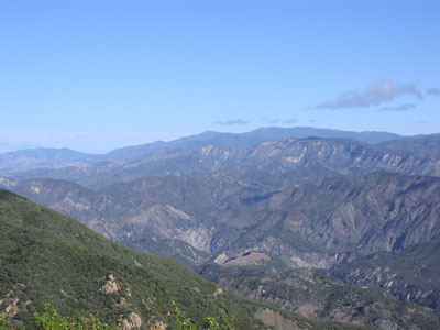
The San Rafael Mountains are a mountain range in central Santa Barbara County, California, U.S., separating the drainages of the Santa Ynez River and the Santa Maria River. They are part of the Transverse Ranges system of Southern California which in turn are part of the Pacific Coast Ranges system of western North America.
Sisquoc Falls is a large plunge type waterfall located in the San Rafael Mountains of Santa Barbara County, California, about 65 miles (105 km) east of Santa Maria. It is located in the backcountry of the San Rafael Wilderness on Falls Canyon Creek, a tributary of the Sisquoc River. One of the tallest waterfalls in Southern California, the falls stand at least 250 feet (76 m) high, dropping off th
Sisquoc Falls is a large plunge type waterfall located in the San Rafael Mountains of Santa Barbara County, California, about 65 miles (105 km) east of Santa Maria. It is located in the backcountry of the San Rafael Wilderness on Falls Canyon Creek, a tributary of the Sisquoc River. One of the tallest waterfalls in Southern California, the falls stand at least 250 feet (76 m) high, dropping off th
🛒 Amenities & services
🚻 Toilets & showers
- Public toilets
Weather
Current conditions and the forecast to help you plan your trip.
Best time to visit
Typical monthly temperature and rainfall at Sycamore Camp.
Good to know
Quick answers to common questions about Sycamore Camp.
Do I need to book ahead for Sycamore Camp?
No — it's first-come, first-served.
Who runs Sycamore Camp?
Sycamore Camp is operated by United States Forest Service.
Reviews
Ratings, nightly prices and photos from people who’ve camped here.
No reviews yet — be the first!
Other campgrounds nearby
More places to camp close to Sycamore Camp.
- Cliff Camp
- South Fork Camp
- Lonnie Davis Campground
- Happy Hunting Ground Campground
- Painted Rock Camp
- Abel Canyon Campground · United States Forest Service