Third Stream Crossing
Facilities & details
Amenities and on-site features reported for Third Stream Crossing.
Know before you go
Practical things to prepare for a trip to Third Stream Crossing.
- No drinking water on site — bring enough for your whole stay.
- This is a backcountry site — you'll need to carry in your gear and water.
Location
Where Third Stream Crossing sits on the map and how to get there.
Nearby cities & towns
Towns and cities closest to Third Stream Crossing — browse campsites near each.
What’s nearby
Shops, drinking water, fuel and attractions within reach of the site.
🏞️ Attractions

Bonita Falls are a set of waterfalls in the San Bernardino National Forest, formed by unnamed tributary to South Fork Lytle Creek, that is said to be 370 or 400 feet (113 or 122 meters) in height, but possibly up to 495 feet high because of two undocumented drops in the canyon above. It is the second tallest in the national forest, being surpassed only by 500-foot (150 m) Big Falls. These two wate

Etiwanda Falls is a waterfall in North Etiwanta Preserve in Rancho Cucamonga, California. It is fed by East Etiwanda Creek and can be accessed through a short 1.6 mi (2.6 km) hike into a canyon. The approximately 50 ft (15 m) falls were created by two streams that merged and funneled the water into one area. It has three drops, which are about 15 ft (4.6 m), 10 ft (3.0 m), and 25 ft (7.6 m) respec
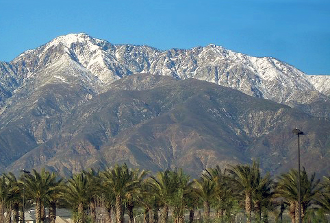
Cucamonga Peak is one of the highest peaks of the San Gabriel Mountains in San Bernardino County, California, with a summit elevation of 8,862 feet (2,701 m). It is within the Cucamonga Wilderness of the San Bernardino National Forest. It is named after the 19th-century Mexican land grant, Rancho Cucamonga, that was below it.


The Cucamonga Wilderness is a federally designated wilderness area located in the eastern San Gabriel Mountains, in San Bernardino County, Southern California.
.jpg?width=640)

Timber Mountain is a peak of the San Gabriel Mountains, located in the Cucamonga Wilderness, Angeles National Forest, San Bernardino County, California.
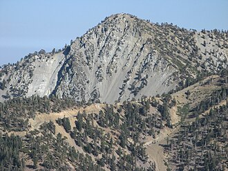
Telegraph Peak, is a peak of the San Gabriel Mountains, in the San Gabriel Mountains National Monument and San Bernardino County, California.

Le refuge de ski San Antonio, en anglais San Antonio Ski Hut, est un refuge de montagne américain dans le comté de San Bernardino, en Californie. Situé à environ 2 530 mètres d'altitude dans les monts San Gabriel, il est protégé au sein du San Gabriel Mountains National Monument. Construit en 1936, il est géré par le Sierra Club.
🛒 Amenities & services
🛒 Groceries
 Shell
Shell- Rocket
- ExtraMile
⛽ Fuel
 Chevron
🍽️ Food & drink
- The Notch
- Buckhorn Lodge
- Restaurant
🚰 Drinking water
- Drinking water
🚻 Toilets & showers
- Public toilets
🎾 Sports
- Lytle Creek Firing Line
- Swimming pool
- Route 66 Shooting Sports Park
Weather
Current conditions and the forecast to help you plan your trip.
Best time to visit
Typical monthly temperature and rainfall at Third Stream Crossing.
Good to know
Quick answers to common questions about Third Stream Crossing.
How much does it cost to camp at Third Stream Crossing?
Third Stream Crossing is free to camp at.
Can I bring an RV or caravan to Third Stream Crossing?
No, caravans and RVs aren't permitted here.
Can I pitch a tent at Third Stream Crossing?
Yes, tent camping is allowed.
Is there drinking water at Third Stream Crossing?
No — bring your own drinking water.
Who runs Third Stream Crossing?
Third Stream Crossing is operated by USFS.
Reviews
Ratings, nightly prices and photos from people who’ve camped here.
No reviews yet — be the first!
Other campgrounds nearby
More places to camp close to Third Stream Crossing.
- Commanche · USFS
- Stonehouse · USFS
- Kelly Camp
- Joe Elliot Yellow Post Sites · United States Forest Service
- Stockton Flats Yellow Post Sites · US Forest Service
- Cedar Glen Campground