Walcha East Rest Area
Facilities & details
Amenities and on-site features reported for Walcha East Rest Area.
Know before you go
Practical things to prepare for a trip to Walcha East Rest Area.
- No toilets here — come prepared and pack out waste (Leave No Trace).
Location
Where Walcha East Rest Area sits on the map and how to get there.
Nearby cities & towns
Towns and cities closest to Walcha East Rest Area — browse campsites near each.
What’s nearby
Shops, drinking water, fuel and attractions within reach of the site.
🏞️ Attractions
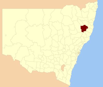
Walcha Shire is a local government area located in the New England region of New South Wales, Australia. The Shire is situated adjacent to the junction of the Oxley Highway and Thunderbolts Way and is 20 kilometres (12 mi) east of the Main North railway line passing through Walcha Road. The shire was formed on 1 June 1955 through the amalgamation of Apsley Shire and the Municipality of Walcha. The
🛒 Amenities & services
🛒 Groceries
- The Fruit Shop
 Foodworks
 IGA
IGA
⛽ Fuel
 Apsley Motors
- NRMA Mountain Motors
 Walcha Tyres
🍽️ Food & drink
- Bbq
- New England Hotel
- Walcha Royal Cafe
➕ Medical
- Walcha Multi-Purpose Service
 Amcal
Amcal
🚰 Drinking water
- Drinking water
🚻 Toilets & showers
- Public toilets
- McHattan Park
🎾 Sports
- Swimming pool
- Tennis
- Cricket
🏧 ATM & bank
 Commonwealth Bank
- Regional Australia Bank
- NAB
Weather
Current conditions and the forecast to help you plan your trip.
Best time to visit
Typical monthly temperature and rainfall at Walcha East Rest Area.
Good to know
Quick answers to common questions about Walcha East Rest Area.
Are there toilets at Walcha East Rest Area?
No, there are no toilets on site.
Reviews
Ratings, nightly prices and photos from people who’ve camped here.
No reviews yet — be the first!
Other campgrounds nearby
More places to camp close to Walcha East Rest Area.
- Walcha Caravan Park
- Apsley Gorge Campground · NSW National Parks and Wildlife
- Tia River Rest Area
- Tia Falls Campground
- Woolbrook Rest Area
- Woolbrook Hall