Bosavern House
Location
Where Bosavern House sits on the map and how to get there.
Nearby cities & towns
Towns and cities closest to Bosavern House — browse campsites near each.
What’s nearby
Shops, drinking water, fuel and attractions within reach of the site.
🏞️ Attractions


St Just (Cornish: Lannust), also known as St Just in Penwith, is a town and civil parish in Cornwall, England, United Kingdom. It lies along the B3306 road which connects St Ives to the A30 road. The parish encompasses the town of St Just and the nearby settlements of Trewellard, Pendeen and Kelynack: it is bounded by the parishes of Morvah to the north-east, Sancreed and Madron to the east, St B


Cape Cornwall (Cornish: Kilgoodh, meaning "goose back") is a small headland in West Cornwall, England. It is 4 miles (6.4 km) north of Land's End near the town of St Just. Until the first Ordnance Survey in the early 19th-century, Cape Cornwall was believed to be the most westerly point in Cornwall. Most of the headland is owned by the National Trust. National Coastwatch has a look-out on the seaw

Chapel Carn Brea is an elevated Hercynian granite outcrop, owned by the National Trust at the southern edge of the civil parish of St Just, Cornwall, England, United Kingdom. The hill is 5 kilometres (3.1 mi) south of St Just and 3.5 kilometres (2.2 mi) east of Sennen Cove, and just to the north of the A30 London to Land's End road, which runs through the village of Crows-an-Wra. It should not be

Cape Cornwall Mine was a tin mine on Cape Cornwall, a cape at the western tip of Cornwall, England, United Kingdom. It operated intermittently between 1838 and 1883, after which time it closed permanently and the engine house was demolished. The mine's 1864 chimney near the peak of the cape was retained as an aid to navigation, and in the early 20th century the former ore dressing floors were for
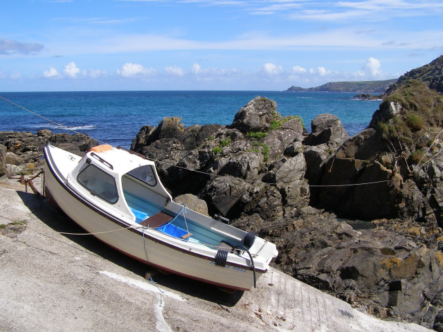
Pendeen (from Cornish: Penn Din meaning "headland fort", previously known as Cornish: Boskaswal Wartha, meaning "Caswal's high dwelling") is a village and ecclesiastical parish on the Penwith peninsula in Cornwall, England. It is 3 miles (5 kilometres) north-northeast of St Just and 7 mi (11 km) west of Penzance. It lies along the B3306 road which connects St Ives to Land's End and the A30 road. T
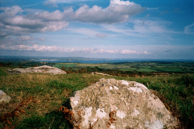
Sancreed Beacon is a Bronze Age archaeological site near the village of Sancreed in the Penwith peninsula of Cornwall maintained by the Cornwall Heritage Trust. On top of the hill are several stone cists and Bronze Age archaeological remains comprising burial mounds and the remains of a Bronze Age hut on the Western slope. This site can be taken in the context of a rich variety of archaeological e


hill in Cornwall, England, UK

Sennen Cove Lifeboat Station is the base for Royal National Lifeboat Institution (RNLI) search and rescue operations for the sea around Land's End, Cornwall in the United Kingdom. The first lifeboat was stationed at Sennen Cove in 1853. Since 2009 it has operated a Tamar-class all-weather boat (ALB) and a D-class (IB1) inshore lifeboat (ILB).
🛒 Amenities & services
🛒 Groceries
 Premier
 Co-op Food
- Stones Fruit & Veg
⛽ Fuel
- Trewellard Garage
 Gulf
 Asda
🍽️ Food & drink
- London House Cafe & Restaurant
- The Star Inn
- Kegen Teg Cafe
➕ Medical
- Day Lewis Pharmacy
- Cape Cornwall Surgery
- Newlyn Pharmacy
🚰 Drinking water
- Drinking water
🚻 Toilets & showers
- Public toilets
- Showers
- Newlyn Fore Street
🎾 Sports
- Sports
- Skateboard
- St Just FC
🏧 ATM & bank
- ATM
 HSBC UK
 Santander
Weather
Current conditions and the forecast to help you plan your trip.
Best time to visit
Typical monthly temperature and rainfall at Bosavern House.
Reviews
Ratings, nightly prices and photos from people who’ve camped here.
No reviews yet — be the first!
Other campgrounds nearby
More places to camp close to Bosavern House.